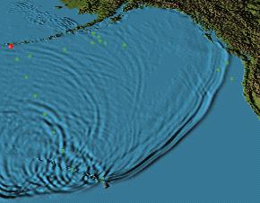
This is still shot of a Cartographic Animation of a Tsunami. Cartographic Animations can demonstrate activity natural occurrences. These maps help give the public an explanation for such disasters.
This is map is found at:
http://nctr.pmel.noaa.gov/Titov/show/
No comments:
Post a Comment