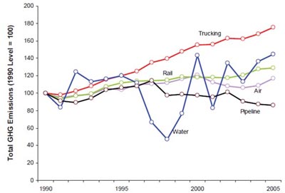
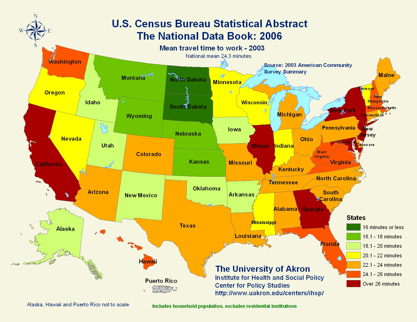
This is a range graded proportional circle map. The ranged graded map overlaps more than one variable. By looking at the map above, you can distinguish where the Hispanic population is in the United States. In addition, you can also distinguish how the Hispanic population compares to the rest of the population of the state.
This map is located at:
https://www.e-education.psu.edu/natureofgeoinfo/book/export/html/1553


 This is an Isohyet map of the Island of Kauai in Hawaii. This map charts the rainfall on the island.